Harrisova metoda
Harris’ stratigraphic method /
Stratigraphic relation /
Harris Matrix /
WINBASP and ArchEd programs /
links
„Harris’ stratigraphic method“
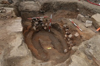
Every archaeological site consists of a series of partial anthropogenic activities – mainly layers and pits, or as well graves, walls or wooden building elements superimposed one upon the other, intersecting or overlaying. They represent the basic sources for discovering the development of given site. To understand this history, every particular must be recognised and described separately, and it is necessary to discover the relations among them, i. e. the site’s stratigraphy. A general term for these particulars is the STRATIGRAPHIC UNIT (abbr. SU). We prefer this term to the equally used notion CONTEXT, which in Czech language induces a slightly different meaning, namely broader connections of various phenomena. A stratigraphic unit creates a part of superincumbent layers in given area; it emerged through natural processes or human activity in the past. A stratigraphic unit represents the lowest component of a field situation, which is classified to 5 groups after its character: deposit (layer, filling), cutting, building construction, contact area and burial. In general there are just two main types of stratigraphic units: deposit and contact area. Building constructions and various kinds of burials represent some specific sorts of deposits, yet demanding separate description items. Cutting is a special kind of contact area. Within the scope of proper deposits we distinguish a layer and a filling. The criterion necessary to be assigned to the subgroup ‘filling’ is the position within a pit or in the area determined through building constructions, all the other deposits are layers. A written record is made with the help of a special blank, the content of which as well as the way of completing are exactly set out. The aim is to secure that everyone describes the SU in the same way, e. g. the maximum standardisation of written documentation possible.
Stratigraphic relation
Very important information is represented through recognizing the relation of one SU to the other ones (so-called stratigraphic relation). These are reduced to three basic relations:
"Harris Matrix"
The series of stratigraphic units following one after another is also called a stratigraphic sequence. The relations within such sequence are recorded in a diagram known as the site matrix (Harris’ flow diagram or the Harris Matrix). In fact the most important part of research is to record these relations because they represent a key both to the events at particular site and to the reconstruction of their time succession.
WINBASP and ArchEd programs
Although at the beginning of the 1990s the “Harris Matrices” had been processed graphically in text editors, this way was quite quickly replaced by evaluating the stratigraphic relations with the help of a program within the scope of the software “package” BASP - The Bonn Archaeological Software Package from the colleagues from Bonn in Germany, which however operates under the older system MS DOS. Since 1999 the workers of our company thus prefer to use the program ArchEd 1.0 operating under MS Windows and developed today under the heading of the Vienna University. Within the framework of the STRATUM application the export of data was created just into this program. The question of a reverse import into the database isn’t solved yet.
„Harris’ stratigraphic method“
Every archaeological site consists of a series of partial anthropogenic activities – mainly layers and pits, or as well graves, walls or wooden building elements superimposed one upon the other, intersecting or overlaying. They represent the basic sources for discovering the development of given site. To understand this history, every particular must be recognised and described separately, and it is necessary to discover the relations among them, i. e. the site’s stratigraphy. A general term for these particulars is the STRATIGRAPHIC UNIT (abbr. SU). We prefer this term to the equally used notion CONTEXT, which in Czech language induces a slightly different meaning, namely broader connections of various phenomena. A stratigraphic unit creates a part of superincumbent layers in given area; it emerged through natural processes or human activity in the past. A stratigraphic unit represents the lowest component of a field situation, which is classified to 5 groups after its character: deposit (layer, filling), cutting, building construction, contact area and burial. In general there are just two main types of stratigraphic units: deposit and contact area. Building constructions and various kinds of burials represent some specific sorts of deposits, yet demanding separate description items. Cutting is a special kind of contact area. Within the scope of proper deposits we distinguish a layer and a filling. The criterion necessary to be assigned to the subgroup ‘filling’ is the position within a pit or in the area determined through building constructions, all the other deposits are layers. A written record is made with the help of a special blank, the content of which as well as the way of completing are exactly set out. The aim is to secure that everyone describes the SU in the same way, e. g. the maximum standardisation of written documentation possible.
Stratigraphic relation
Very important information is represented through recognizing the relation of one SU to the other ones (so-called stratigraphic relation). These are reduced to three basic relations:
a) the SU investigated is older than the others (it is stratigraphically below)
b) the SU investigated is younger than the others (it is stratigraphically above)
c) the SU investigated is in no direct stratigraphic relation to any other SU (they are not in contact).
b) the SU investigated is younger than the others (it is stratigraphically above)
c) the SU investigated is in no direct stratigraphic relation to any other SU (they are not in contact).
"Harris Matrix"
The series of stratigraphic units following one after another is also called a stratigraphic sequence. The relations within such sequence are recorded in a diagram known as the site matrix (Harris’ flow diagram or the Harris Matrix). In fact the most important part of research is to record these relations because they represent a key both to the events at particular site and to the reconstruction of their time succession.
WINBASP and ArchEd programs
Although at the beginning of the 1990s the “Harris Matrices” had been processed graphically in text editors, this way was quite quickly replaced by evaluating the stratigraphic relations with the help of a program within the scope of the software “package” BASP - The Bonn Archaeological Software Package from the colleagues from Bonn in Germany, which however operates under the older system MS DOS. Since 1999 the workers of our company thus prefer to use the program ArchEd 1.0 operating under MS Windows and developed today under the heading of the Vienna University. Within the framework of the STRATUM application the export of data was created just into this program. The question of a reverse import into the database isn’t solved yet.
Patrimonium pro futuro
12. 06. 2025 – – zobrazit
Přátelé, sledující,
moc bychom si vážili toho, kdybyste nás podpořili v
hlasování „Patrimonium pro futuro“, které je každoročně vyhlašováno
Národním památkovým ústavem...


